The Best Drones for Building Inspections: A Practical Overview
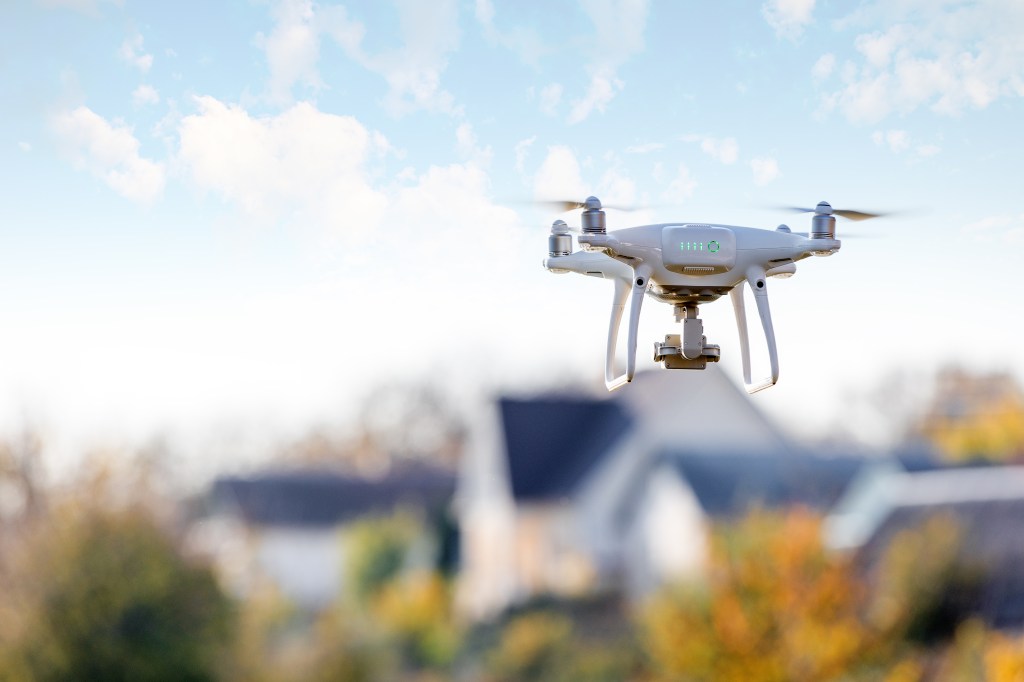
When a property sits vacant, simply understanding its condition can quickly become costly and time‑consuming. Rooflines, façades, and upper floors often require lifts, scaffolding, or repeated site visits when relying on manual inspections, each step adding expense, risk, and delays. That’s why drone technology is rapidly becoming a smarter alternative for building assessments.
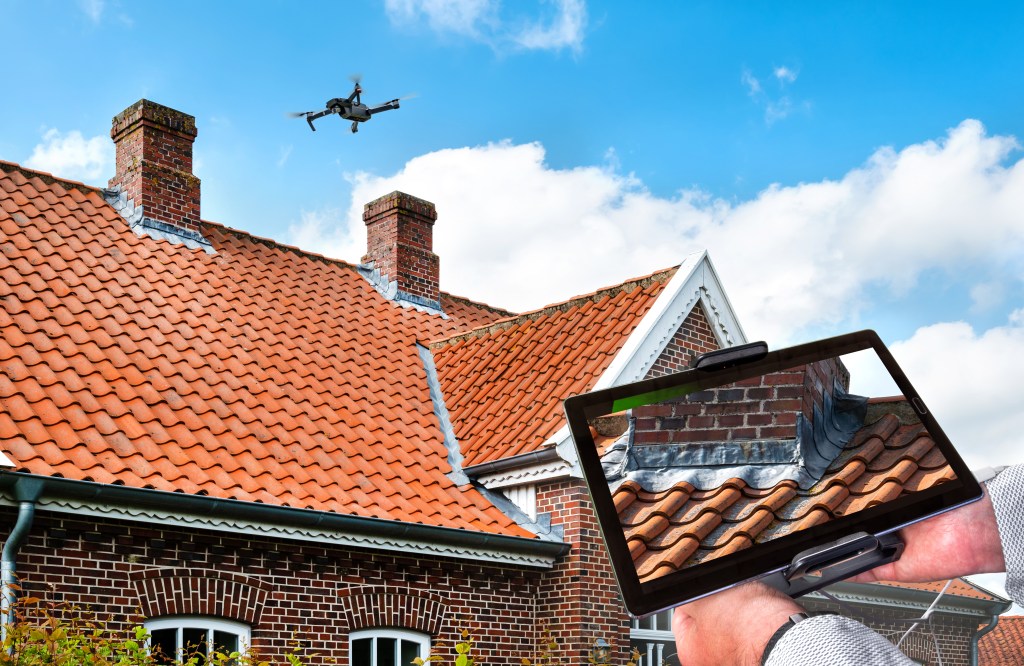
With drone roof inspection software, a vacant property can be surveyed from every angle in a single flight, capturing high‑resolution imagery and precise measurements without placing inspectors on ladders or disrupting the site. The result is accurate data that clearly documents the building’s true condition, supporting better decisions with fewer assumptions.
Beyond efficiency, the safety advantages are substantial. Drone inspections eliminate much of the risk associated with working at height while delivering comprehensive visual records that insurers and stakeholders increasingly expect. As carriers demand detailed, up‑to‑date documentation before accepting risk, drone‑based inspections move beyond a “nice‑to‑have” innovation; they become a practical, reliable tool for reducing exposure and strengthening underwriting submissions.
What Drone and Aerial Inspections Actually Capture
A drone inspection captures far more than a quick walk‑around ever could. During a typical flight, drone aerial inspections for vacant buildings collect visual data across the entire structure, creating a detailed body of inspection data without exposing crews to unnecessary safety risks. For roof inspections, straight‑down imagery reveals ponding water, membrane deterioration, damaged flashing, and other early warning signs that are rarely visible from the ground.
Angled views document parapets, gutters, edges, and transitions, areas where failures and leaks are most likely to begin, while close‑up imagery of façades, windows, and structural joints highlights cracks, gaps, loose materials, or debris. Modern drone platforms capture high‑resolution photos and video from multiple distances and perspectives, delivering a level of clarity that manual inspections simply can’t achieve safely or efficiently.
By bringing these vantage points together, a drone survey provides a comprehensive, accurate picture of a building’s condition. This depth of visual documentation allows vacant property owners and insurers to identify issues early, reduce unknowns, and address risks before minor defects turn into costly repairs, all while minimizing exposure to the hazards of traditional inspection methods.

Hard-To-Access Areas: Where Drones Beat Ladders and Lifts
Drones are especially effective when inspection areas are high off the ground, awkwardly positioned, or obstructed by surrounding structures. For this kind of drone roof inspection work, having experienced drone pilots and a drone equipped to navigate tight spaces and complex geometry makes all the difference. These aerial inspections for hard‑to‑access infrastructure eliminate the need to mobilize ground crews, close parking lots, or rent lifts and scaffolding just to reach a single problem area.
Instead, a drone can safely maneuver around towers, atriums, overhangs, and intricate rooflines with precision and speed. On a quiet, vacant site, drone pilots can capture the necessary visuals in minutes, making drones an ideal solution for remote inspections of empty properties.
By dramatically reducing reliance on traditional access equipment, drone inspections also help control costs tied to scaffolding and lift rentals. This efficiency is particularly valuable for vacant buildings that still require routine oversight but don’t generate rental income to offset the expense of conventional inspection methods.
What Carriers Want to See from Drone Roof Inspection Software
When it comes to drone inspections, insurance carriers aren’t focused on the novelty of the technology, they’re focused on the quality, consistency, and clarity of the information drone operations deliver. Within the modern drone industry, carriers expect clear, high‑resolution imagery that accurately documents the condition of roof surfaces, flashing, drains, parapets, and any visible signs of wear or damage. This level of detail is essential for producing carrier‑accepted drone inspection reports that support confident underwriting decisions.
Insurance carriers also look for complete, well‑organized documentation, including inspection dates, clearly defined flight coverage, and labeled images tied to specific building components. When drone inspection visuals are structured and easy to navigate, they become valuable inspection data for underwriting teams, allowing risks to be evaluated with greater precision and fewer assumptions.
Beyond underwriting, well‑executed drone operations strengthen long‑term inspection records and claims support. Time‑stamped, clearly annotated visuals give adjusters reliable reference points for comparing property conditions before and after an incident, enabling faster, more accurate claims handling. As drone adoption continues to mature across the drone industry, insurers increasingly view high‑quality drone inspection documentation not as supplemental information but as a trusted tool for risk assessment, loss prevention, and informed coverage decisions.
Drone Roof Inspections: Ponding, Debris, and Damage
Roof inspection drone services are among the most valuable applications of aerial imaging for vacant properties, largely because roof‑related issues remain some of the most frequent, and expensive, problems owners encounter. A drone‑based roof inspection for insurance captures both overhead and oblique angles, providing clear visibility into conditions that are often missed from the ground. These views can reveal ponding water caused by drainage issues, debris buildup around clogged drains and scuppers, torn or deteriorating membranes on flat roofs, missing or damaged shingles on pitched sections, and impact marks that suggest hail strikes or fallen tree debris.
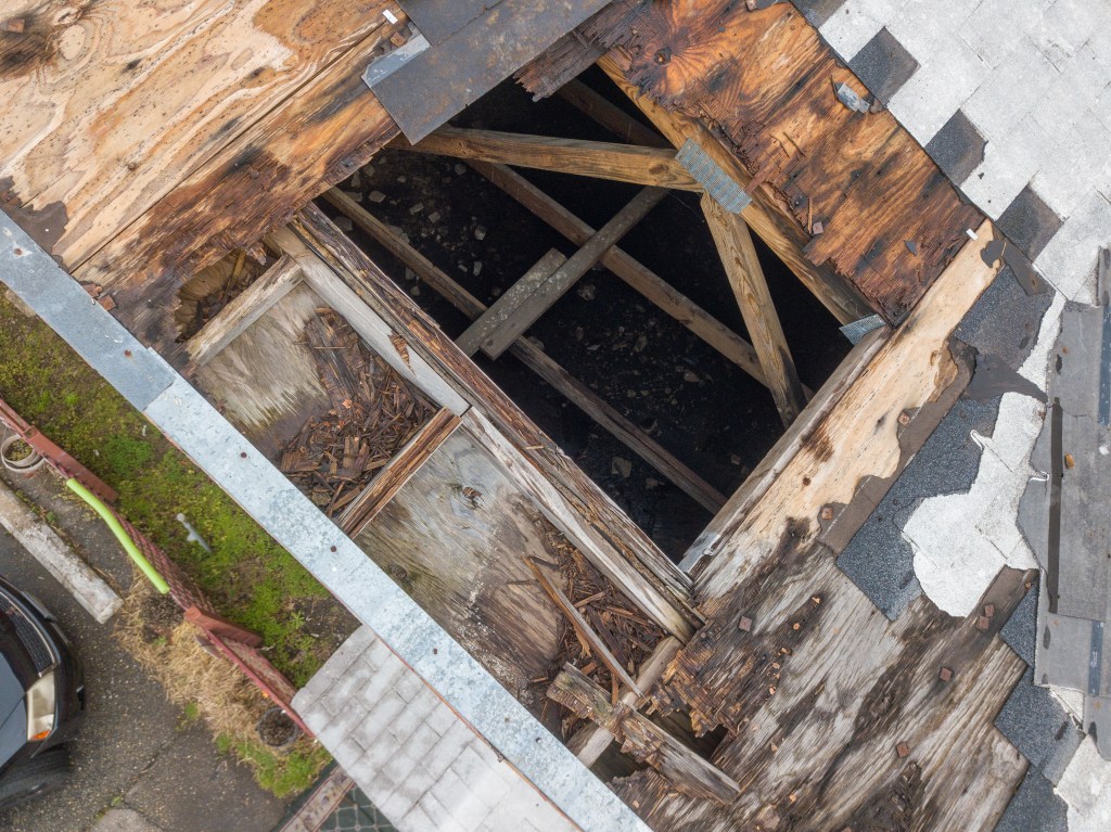
Modern roof inspection drone flights can also produce orthomosaic roof imagery, creating a stitched, map‑like view of the entire roof surface. This comprehensive perspective allows owners and insurers to compare conditions over time, making changes and emerging concerns easier to identify. High‑resolution imagery supports precise visual defect detection with drones, helping spot minor issues before they escalate into major repairs.
Equally important, drone imagery creates a reliable, time‑stamped visual record of roof conditions before and after major weather events. For insurance and risk management purposes, this documentation can be invaluable if questions arise about when damage occurred or whether it existed before a storm, providing clarity, consistency, and confidence for all stakeholders involved.
Façade and Envelope Checks: Cracks, Gaps, and Water Paths
Façade and building envelope issues can quietly lead to significant damage, especially in vacant properties where leaks and deterioration may go unnoticed for extended periods. A drone façade inspection supports more comprehensive data collection by allowing close‑up examination of exterior walls, cladding systems, and window assemblies from multiple angles. Using high‑resolution cameras, drones capture detailed, high‑resolution photos that clearly reveal cracks, gaps, open joints, rust staining, deteriorated sealants, and other signs of structural wear that may indicate potential water intrusion paths.
By identifying these issues early, well before moisture migrates into occupied spaces or structural components, property owners can avoid costly interior damage and long‑term degradation. Incorporating a vacant building drone survey into routine maintenance programs not only improves visibility into façade conditions but also demonstrates to insurance carriers that proactive steps are being taken to monitor and manage the building envelope, rather than waiting for minor issues to escalate into claims.
Beyond “Pretty Pictures”: Data Collection and Report Format
Drone inspections offer far more than “pretty pictures”; their true value lies in how effectively the results of exterior inspections are organized, presented, and delivered. For insurance and risk management purposes, clarity and structure matter just as much as the quality of the visuals themselves. While drones provide high‑quality images, the strongest outcomes come from pairing those visuals with detailed reports that make the data easy to understand and apply.
Carrier‑accepted inspection deliverables often include clearly annotated PDFs, intuitive web galleries with labeled views, or advanced outputs such as orthomosaic roof imagery with notes and callouts. These formats allow brokers, underwriters, and claims teams to quickly review conditions without sorting through dozens of unlabeled files.
For vacant property owners, the most important factor is working with a provider who delivers well‑organized, clearly labeled documentation that can be sent directly to a broker or insurance carrier without additional cleanup. When drone inspections result in structured data rather than a loose collection of images, they become a powerful tool for underwriting, ongoing documentation, and claims support, transforming exterior inspection visuals into actionable insight instead of administrative overhead.
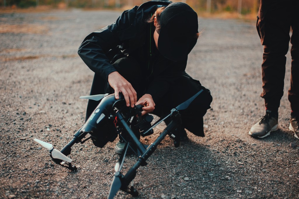
Safety, Liability, and Licensed Drone Pilots
Safety and liability are major concerns for any property owner, and this is where modern drone technology delivers a clear advantage over traditional methods. Professional drone pilots provide a safer alternative to ladders, lifts, and rooftop access while producing reliable aerial data that supports informed decision‑making. By eliminating the need for inspectors to work at height, drone inspections significantly reduce the risk of falls, equipment accidents, and on‑site disruptions associated with conventional inspection approaches.
Qualified drone operators follow all required aviation and licensing standards, maintaining current certifications and carrying their own insurance coverage. They also apply proven flight procedures when operating near buildings, power lines, and adjacent properties, ensuring controlled and compliant drone operations during aerial inspections of hard‑to‑access infrastructure.
For property owners, partnering with professional drone pilots removes regulatory uncertainty and minimizes liability exposure. Just as important, it gives insurance carriers confidence that inspections were performed safely, professionally, and in accordance with industry standards. Compared with traditional methods, drone‑based inspections not only enhance safety on site but also increase the credibility and reliability of the aerial data shared with insurers, strengthening documentation for underwriting, risk management, and future claims support.
Common Issues With Drone Data Capture Inspections (and How To Avoid Them)
Drones are powerful inspection tools, but they are not without limitations, and understanding those limits is essential for obtaining reliable results. Some of the most common challenges arise from environmental conditions. High winds can affect flight stability and impact image clarity, particularly when assessing roof systems where wind resistance is a critical factor. Rain, low light, or glare from reflective surfaces can also reduce image quality, which is especially important during post‑storm inspections when timely, accurate documentation is essential.
Complex architecture presents another challenge. Tight corners, deep overhangs, and obstructed sightlines can make it difficult for drones to capture certain angles unless the flight is carefully planned. When operators rush a flight or fail to design proper coverage patterns, parts of the roof or façade, and sometimes the entire site, may be only partially documented. This can result in inspection gaps similar to those seen in traditional assessments, without delivering the intended safety or efficiency benefits.
That’s why experience, planning, and process matter. Reputable providers account for weather, lighting, and building geometry when planning drone operations, ensuring consistent coverage while controlling labor costs compared to scaffolding‑ or lift‑based inspections. Asking upfront how a provider handles adverse conditions, plans flight paths, and structures deliverables can help avoid incomplete results.
With the right questions and the right provider, drone inspections deliver a safer, faster alternative to traditional assessment methods, without sacrificing the thoroughness insurers and property owners require.
Drones For Underwriting Versus Drones For Claims
Drones play a critical role at two key points in the insurance cycle, before a policy is bound and after a loss occurs. For underwriting within the insurance industry, drone inspections provide a comprehensive view of a property’s current condition. High‑quality aerial data and detailed images allow carriers to verify that a building is secure, reasonably maintained, and free from obvious hazards, delivering the level of thorough coverage underwriters need to assess risk with confidence. This visibility can support more favorable terms, smoother renewals, or help maintain coverage for vacant properties that might otherwise be viewed as higher risk.
After an incident, the value of drone inspections shifts but remains just as important. In claims scenarios, time‑stamped drone imagery creates a clear “before and after” record that shows exactly what changed. These detailed images give adjusters and claims teams a comprehensive visual reference, reducing uncertainty, minimizing disputes, and accelerating claim evaluations.
By consistently documenting property conditions with organized, carrier‑ready drone inspections, owners provide insurers with reliable evidence that supports both underwriting and claims. This structured approach improves transparency, strengthens trust, and helps create a more efficient, data‑driven relationship between property owners, brokers, and the insurance industry.
Combining Drones With On-The-Ground Checks
While drones excel at capturing wide‑angle perspectives and detailed exterior imagery, they are not a complete replacement for traditional inspection methods. Ground‑level walkthroughs still play a critical role, allowing inspectors to identify conditions drone data cannot reveal, such as issues at door thresholds, drainage flow problems, or hazards concealed beneath overhangs. Interior inspections remain essential for understanding moisture intrusion, mechanical system performance, life‑safety concerns, and security issues that exterior flights cannot address.
The greatest value comes from combining aerial and on‑site inspections into a single, coordinated process. A vacant building drone survey delivers fast, high‑quality drone data covering roofs, façades, and other hard‑to‑reach areas, while on‑the‑ground assessments fill in structural, operational, and interior details. This blended approach supports regulatory compliance by ensuring all required inspection elements, both exterior and interior, are properly documented.
For property managers, this integrated strategy creates a fuller, more defensible picture of risk. Drone technology enhances efficiency and coverage, while traditional inspections validate conditions up close, ensuring nothing critical is overlooked. Together, these methods produce a comprehensive, carrier‑ready inspection file for vacant properties, one that improves underwriting confidence, supports claims decisions, and demonstrates a proactive, professional approach to risk management.
How Often Should You Use Drone Inspections and Drone Operations On Empty Buildings?
Determining how often to use drone inspections on an empty building comes down to balancing risk, weather exposure, and how long the property will sit unoccupied. A smart approach begins with a vacant home or building drone survey as soon as the property becomes empty, creating a clear visual baseline of its initial condition. From there, owners should plan additional flights after major weather events, such as heavy storms, hail, or high winds, to spot any new roof or façade damage that may not be visible from the ground.
For properties expected to sit vacant for a year or more, establishing a seasonal drone inspection schedule helps catch ponding, debris buildup, and envelope deterioration before they escalate. Regular drone aerial inspections for vacant buildings turn drones into part of a predictable, repeatable maintenance plan, not a one‑time novelty flight, helping owners manage risk and maintain a strong insurance file over time.
Choosing A Drone Vendor Your Carrier Will Take Seriously
Choosing a drone vendor that your carrier will take seriously comes down to verifying a few essentials. Look for licensed operators who carry their own insurance, have real experience with Drones for Building Inspections, not just capturing marketing footage, and can provide sample reports that mirror what carriers expect, including carrier‑accepted drone inspection reports that clearly highlight defects rather than just pretty angles.
Ask whether they’ve worked with insurers before and whether they can tailor deliverables to the formats brokers and carriers typically request. A provider who understands underwriting standards, documentation expectations, and how to structure drone inspection documentation for insurers will make your submissions stronger and your renewal conversations smoother.
When you choose the right partner, drone and aerial inspections become a repeatable, credible way to impress underwriters, streamline evidence requests, and protect your vacant building for the long haul.

Sources:
https://candrone.com/blogs/news/beyond-reach-drone-based-inspections-for-hard-to-access-infrastructure
https://cmbinsurance.ca/blog/protecting-unoccupied-and-vacant-buildings/
https://www.eagleview.com/insurance/elevating-the-future-of-claims-inspections-with-eagleview-assess-drone-powered-technology/
https://info.qii.ai/blog/drones-for-building-inspection
https://blog.fenstermaker.com/drone-aerial-inspections/
https://www.hammermissions.com/post/inspections-with-drones-common-issues
